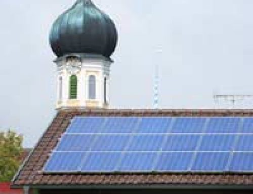
 One of the primary considerations with any site is access and transportation. They are key factors in the success of any development; communities that aren’t readily accessible both inside and outside their boundaries simply aren’t sustainable. Access means safe, secure and healthy movement for all, whether old and young, rich or poor, and the viability of services, such as public transportation.
Contents
Density
One of the problems with sustainable development on a site is that it requires around 40 houses per hectare to support public transportation and facilities like shops and schools. However, the average density on brownfield sites is currently 28 houses per hectare (it’s 22 on greenfield sites). That means the real need is for greater-density, mixed use sites, where houses, shops and business can co-exist, and there remains room for urban greenspace, in order for a community to be properly sustainable. In the Gorbals area of Glasgow, for instance, a 1990 development with 64 houses per hectare used mainly three storey terrace houses and four storey flats, some with shops on the ground floor and offices above. The streets were well-defined, and park space, and roads separated from pavements by a barrier of trees. The development had buses connecting with underground and suburban rail services. It’s proved so successful hat there have been attempts to reproduce it in Manchester, Leeds and London.
Transportation
Studies have shown people are willing to walk 300-400 metres for a bus and 600-800m for light rail. So ensuring developments have good connectivity to public transportation and access to facilities are a vital part of sustainability. In that way public transportation usage will increase, and lessen the use of cars within the community, encouraging walking and bicycling. Cars have their place in this, of course, but their penetration and physical presence needs to be limited. Given that 29% of CO2 emissions in the U.K. come from transportation, and mostly from private cars, the need for integrated access becomes more vital. With rail as the main connection between cities, there would need to be a railway station every 6-km for the public to make good use of rail transportation, and stations can be the hub of a community.
That’s been the case in the vision for Ebbsfleet, in Kent, which has been based around the station. As proposed, the business core will consist of 4.5 million sq ft, eventually creating around 20,000 new jobs over the coming 20 years – a true mixed-use development. The plan is for over 3,000 residential units and 2,190 acres of new parks and open spaces. The transport system has been designed on the expectation that, with the integration of development and transportation, 40% of all journey over one kilometre will be made by non-car modes – double the current figure, and forming a model for future sustainable communities.
Facilities
Facilities are also vital to making a community sustainable – schools, medical centres, shops and leisure centres. Facilities have catchment areas, the amount of people necessary to sustain, say, a school or a business. A good sustainable development with proper density would have shops within 800 metres, parks within a kilometre and leisure centre and a secondary school within two kilometres.
Facilities also need to be connected. Placing shops near a medical centre and a primary school, for instance, with a bus stop within 200 metres, means they enjoy the benefits of close physical association, and people can complete several tasks in one stop. If they’re within 800m of homes, walking will be a more viable option, too. Likewise, if a school shares a hall or playing fields with the community, that’s another form of connectivity and community. In this way the idea of thinking local becomes natural for residents.
Streets
The street is the main thoroughfare in a community. At present it’s used mainly by cars, but in a sustainable development you want to encourage much more movement by public transportation, foot and bicycle. That means much wider pavements, a separate marked cycle path and traffic restrictions. Ideas along these lines were part of the proposals for the community of Clyst Hayes near Exeter, as a “walkable neighbourhood principle” with ready access to the existing railway station. By making an area more friendly to pedestrians, you actively encourage walking.


Hello,I own 2.5 acres of land in south bham.The land in question is I believe brownfield for as long as I have known[I am 68years] and in the 1937 local ordnance survey,market garden etc.since 1880 a large workshop,which served the farm it once belonged to.,demolished about 2000/2002.My council declared the land open space.They say in 2009 and also say they sent mail to the owners,but can not produce the copies of?My city council have refused permission to build care homes on the site.They have also made Cofton park,next my land,2.5 acres larger than previous??? Any help appreciated. Neil.
Dear Neil i know the area that you are talking about and may be able to help. lisa Walker 07976 741122
Is it possible that rural riding school buildings and land, within the green belt, can be designated as brownfield by a local authority so that a new owner is able to develop the land for an insular “church” for members’ sole use, without any community use or function? The recreational amenity has existed for about 30 years and the structures are still in place, having only been vacated a few months ago. Your thoughts would be appreciated, Enquirer
I am involved with community response to a brownfield site which is currently going through outline planning permission, the result of which will be that the site will be marketed by the MOD. Is there any reason in principle why the local authority shouldn’t buy the land and then put together it’s own outline planning application – allowing or a more community friendly plan, even if then developed with a partner developer or through subsequent sale. My concern is that the debate at present is only about the MOD outline application. This is setting the terms of the discussion about what is needed (and they only plan for … lost of houses). What method could be used to develop an entirely different plan. I am assuming the best way would be for the council to buy the land rather than go through with granting outline planning permissions but I need to know if this is possible. Thanks
Councils don’t often have this kind of money available and it’s often easier and more efficient to let a developer undertake building work subject to planning permission and in conjunction with local development plans (which should already in be in place).
We live opposite a car wash which is a new development as it was previously a used car dealership and before that was petrol station. We are hoping that the land will eventually be suitable for development but how do we find out if this could be possible and how much tank removal would cost? Thank you!
Your county council will have a development plan which will give a general picture of the types of developments allowed/planned in the area for the foreseeable future. We don’t know how much tank removal costs, you would need to contact relevant companies to find out.
Our Council has refused planning permission for a well known developer to build 300 houses on land outside the settlement boundary, which is close to where I live.The developers have appealed and it will go to the Planning Inspectorate. How can I support the case against the developer?
Hello, I own some small plots of land in Houndeslow that is green fields land. It is directly next to a main road and opposite housing. Will it be possible to get planning permission for an own build if it is eco-friendly in plan an design.
I got hit by a truck, on my way to my train. transportation sucks
What is the use class of an equestrian holding of private use. Not commercial. As there are buildings I have read this is classed as brownfield. It is not in designated greenbelt And is 1.1 mile to the village centre and bus stop. It was refused conversion twice as being in an unsustainable location. We did not bring up the brownfield site argument in our last application as we did not know about it. How do we overcome the sustainability in terms of transport. It has not been used for horses for past 5 years since last refusal. Thanks
Hi Chris Your article states “Studies have shown people are willing to walk 300-400 metres for a bus and 600-800m for light rail.” Could you point me to where these studies are please?